Skip to header Skip to main navigation Skip to main content Skip to footer

User account menu

  • Log in
Home
American Falls Dam

Main navigation

  • Home
  • Dining
  • Lodging
  • Shopping
  • Things to Do
  • Outdoors
  • History
  • Webcams
  • Business Directory

Idaho History

The Reservoir That Changed the Land
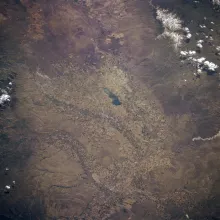
American Falls Reservoir and Pocatello, Idaho, photographed from the Space Shuttle in May 1985.

When the gates of the first American Falls Dam closed, the Snake River backed up for more than twenty miles and became the largest reservoir of the Minidoka Project. American Falls Reservoir stores about 1.7 million acre-feet of water, and at full pool it covers some 56,000 acres with about 100 miles of shoreline. The dam stands in Power County, but the reservoir reaches northeast into Bingham and Bannock Counties, and it remade everything it touched.
  • Read more about The Reservoir That Changed the Land

Power at the Falls: The 1902 Plant and Idaho Power's Early Years

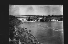
The natural falls at American Falls and the railroad bridge, photographed for the Historic American Engineering Record, HAER ID-2.

Power County is named for a power plant. When the Idaho Legislature created the county on January 30, 1913, with American Falls as its seat, it took its name from the hydroelectric plant at the falls, where the Snake River poured over a series of basalt cascades. The Idaho State Historical Society's county-names reference gives the origin in a single line: "Power: For the power plant at American Falls."

  • Read more about Power at the Falls: The 1902 Plant and Idaho Power's Early Years

Fort Hall and the Shoshone-Bannock Homeland

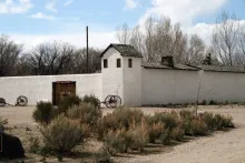
The Fort Hall Replica Museum in Pocatello, Idaho, photographed by National Park Service staff.

Long before there was a town at American Falls, this country was the homeland of the Shoshone and Bannock peoples. The Shoshone-Bannock Tribes are comprised of the eastern and western bands of the Northern Shoshone and the Bannock, or Northern Paiute, bands. Their ancestral lands encompassed present-day Idaho, Oregon, Nevada, Utah, Wyoming, and Montana, and reached into Canada.

  • Read more about Fort Hall and the Shoshone-Bannock Homeland

Register Rock: The Emigrants' Guest Book in Stone

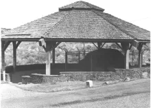
Register Rock sheltered beneath its octagonal pavilion, photographed by Merle W. Wells for the National Register of Historic Places nomination.

Every guest book has a first signature. At Register Rock, the signatures were cut into stone. The rock is a partially buried basalt boulder about twenty-five feet in diameter and nearly seven feet high, standing near Rock Creek and the Snake River, about twelve miles southwest of American Falls. Emigrants on the Oregon and California Trails camped in this spot, rested their animals, and many of them took a few moments to leave their names on the boulder before rolling on west.

  • Read more about Register Rock: The Emigrants' Guest Book in Stone

Massacre Rocks: Where the Oregon Trail Ran a Gauntlet

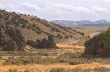
Devil's Gate at Massacre Rocks, the narrow gap in the boulders where Oregon Trail wagons passed in single file.

West of American Falls, the Oregon Trail crossed one of the most storied passages on the whole route west. During the emigrant era of 1840 to 1860, thousands of travelers who had left Fort Hall and crossed the Snake River Plain, more than 1,200 miles out of Missouri, reached a place where the trail narrowed to a gap between enormous basalt boulders on the south bank of the Snake River. Wagons had to pass through in single file. Emigrants called the gap Devil's Gate, and some called it the Gate of Death.

  • Read more about Massacre Rocks: Where the Oregon Trail Ran a Gauntlet

Building the First American Falls Dam

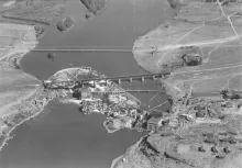
A 1923 aerial photograph of the American Falls dam site on the Snake River, by Captain A. W. Stevens.

The first American Falls Dam was a federal dam. It was built by the United States Bureau of Reclamation as part of the Minidoka Project, the first Reclamation project constructed in Idaho, and the construction work was carried out under contract by the Utah Construction Company. Idaho Power Company did not build the dam. Its part in the story came earlier and later: it owned small hydroelectric plants at the natural falls, it held water rights that Reclamation had to buy out, and it built powerplants at the Reclamation dams in later years.

  • Read more about Building the First American Falls Dam

The Town That Moved: How American Falls Relocated, Building by Building, for Its Dam

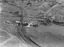
A 1923 aerial photograph of American Falls, Idaho, showing the natural falls, the railroad bridge, the early power plants, and the original townsite.

In 1925, the people of American Falls, Idaho, began moving their town. The Bureau of Reclamation was building a dam on the Snake River as part of the Minidoka Project, and the reservoir behind it would cover about three-quarters of the town. Rather than abandon the site, the residents and the federal government undertook what the City of American Falls describes as the largest government relocation project of its time: nearly the whole town picked up and moved, building by building, to higher ground.

  • Read more about The Town That Moved: How American Falls Relocated, Building by Building, for Its Dam
Subscribe to Idaho History

American Falls, ID Weather

Loading current conditions...

Loading forecast...

Upcoming Events

🎉 American Falls Events Calendar

Annual Favorites:
American Falls Day — First Saturday of August
Power County Fair and Rodeo — August

Coming Up:
Watch the chamber calendar for winter and holiday events in American Falls.

Article Archive

Browse past articles

Copyright © 2026 Rocky Mountain Madman LLC - All rights reserved

Developed and Designed by Rocky Mountain Madman LLC