Long before there was a town at American Falls, this country was the homeland of the Shoshone and Bannock peoples. The Shoshone-Bannock Tribes are comprised of the eastern and western bands of the Northern Shoshone and the Bannock, or Northern Paiute, bands. Their ancestral lands encompassed present-day Idaho, Oregon, Nevada, Utah, Wyoming, and Montana, and reached into Canada.
Life followed the seasons across that wide country. The overlapping traditional territories of the Shoshone and Bannock bands ranged over more than half of what is today Idaho and beyond, from the Salmon River in central Idaho south to northern Utah and Nevada, and east from Oregon to the Continental Divide. Families moved seasonally to fish for salmon, to dig camas roots, and to hunt. Some bands adopted horses around 1700 and traveled east to the Great Plains to hunt bison. The country around the falls, the river crossings, and the camas prairies was not empty land awaiting settlement. It was a working homeland, crossed by trails and sustained by use far older than any map.
In 1834, Nathaniel Jarvis Wyeth built Fort Hall beside the Snake River, an outpost of the Snake country fur trade placed, as the Idaho State Historical Society puts it, in a key area of northern Shoshone and Bannock activity. The National Park Service calls Fort Hall the first permanent American trading post between the Rocky Mountains and the Pacific Coast. Wyeth sold the post to the Hudson's Bay Company three years later, in 1837, and the company closed it in 1856. For the emigrants who followed, Fort Hall became a major supply station on the Oregon Trail. For the Shoshone and Bannock, it stood in the middle of their country, and its trade changed the terms of life there.
On June 14, 1867, President Andrew Johnson issued an executive order designating the Fort Hall Reservation for various bands of Shoshone and Bannock people. A year later, on July 3, 1868, Shoshone and Bannock leadership signed the Fort Bridger Treaty, which affirmed the Fort Hall Reservation as the permanent home of the Shoshone and Bannock people, while preserving their rights to hunt, fish, and gather in their usual and accustomed places beyond the reservation boundaries. In March 1869, Special Agent Charles Powell relocated a few hundred Shoshone-Bannock people from a refugee camp at Boise to the reservation, where the early decades were marked by inadequate federal rations and privation.
The reservation the tribes received was far smaller than the homeland it replaced, and it shrank further. It originally contained about 1.8 million acres. A tribal filing states that a survey error reduced it to 1.2 million acres in 1872, and later legislation and allotment reduced it again, as land was set aside for the town of Pocatello, for railroad rights-of-way and yards, and for irrigation networks. In the 1920s, the new American Falls Reservoir flooded 30,000 acres of reservation land along the river. Each reduction took land that the treaty had affirmed as a permanent home.
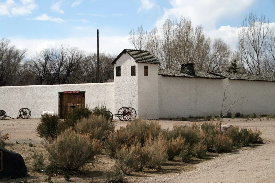
The Fort Hall Reservation endures. It lies in southeastern Idaho between the cities of Pocatello, American Falls, and Blackfoot, and it is divided into five districts: Fort Hall, Lincoln Creek, Ross Fork, Gibson, and Bannock Creek. The Snake River, the Blackfoot River, and American Falls Reservoir border it on the north and northwest. It remains the largest reservation in Idaho at 544,000 acres, 98 percent of which is tribal or trust land, with an enrolled membership of 6,000. The original Fort Hall site, a National Historic Landmark, stands on the reservation and is not open to public visitation. A full-scale replica of the fort, built in Pocatello in the 1960s at the request of the Shoshone-Bannock Tribes, outside the reservation boundaries, preserves the Hudson's Bay Company floor plans for visitors who want to understand what stood in the homeland in 1834.